Connecting the world with better maps
Feb 22, 2016Tobias Tiecke, Andreas Gros
Summary
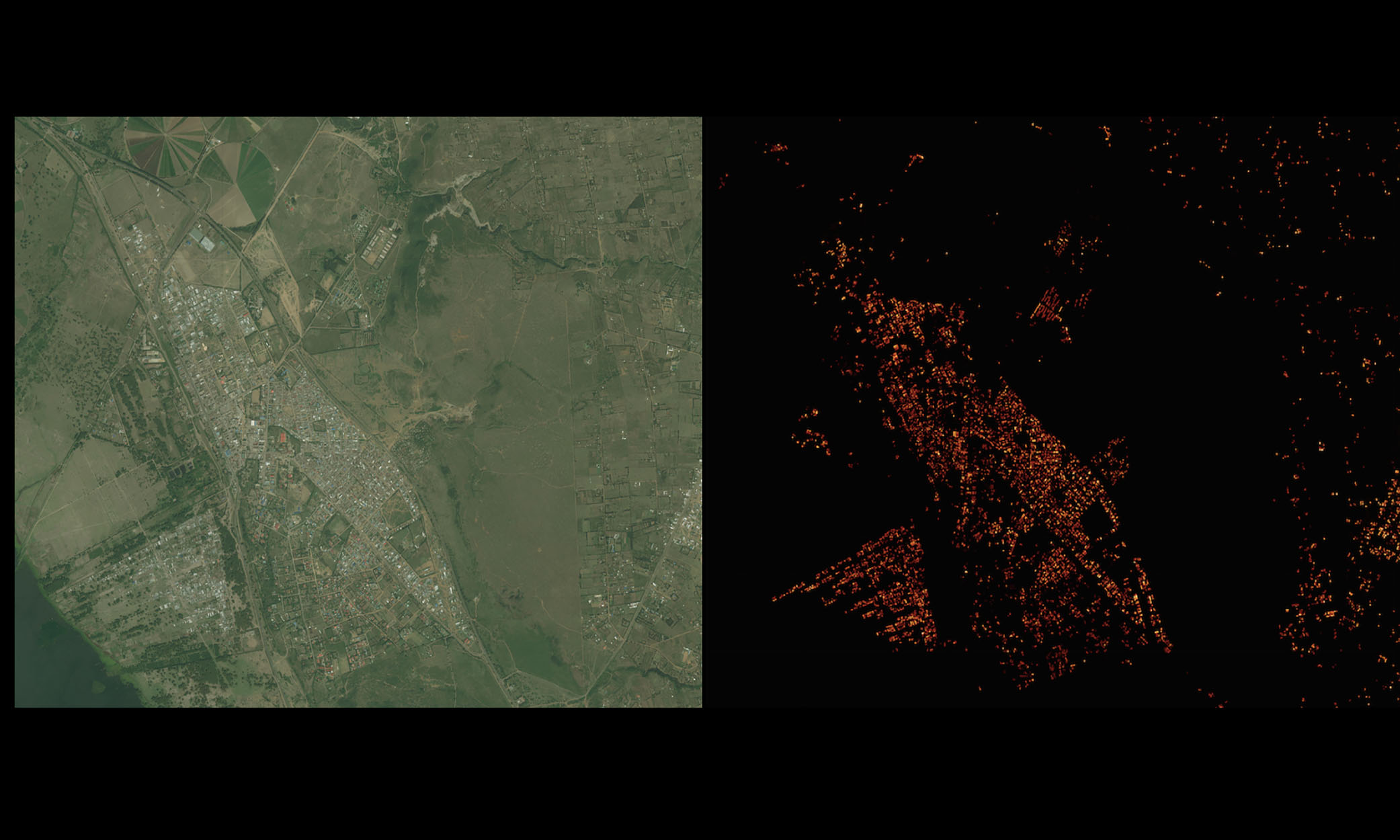
This post details the development of a high-resolution (5-meter) population distribution dataset for 20 countries by applying computer vision techniques to satellite imagery. The process involved identifying human-built structures as proxies for population density, using a combination of image preselection, a modified Facebook image-recognition engine (deep convolutional neural network), and a weakly supervised neural network. The resulting data was used to redistribute census counts, providing granular insights for planning short-range access networks and backhaul solutions for internet connectivity in underserved areas. The scale of the operation involved processing 14.6 billion images on thousands of servers.
More from the Internet Connectivity Expansion and Infrastructure trail
- Escaping the Fork: How Meta Modernized WebRTC Across 50+ Use Cases
- Announcing the Completion of the Core 2Africa System: Building the Future of Connectivity Together
- 10X Backbone: How Meta Is Scaling Backbone Connectivity for AI
- Introducing the Candle Subsea Cable, Updates to Our Asia-Pacific Connectivity Projects
- Extending the Malbec subsea cable to Southern Brazil